_Otszogletu_kek_tabla.svg.png.webp) | |
|---|---|
| M2-es autóút | |
 | |
 M2 near Budapest | |
| Route information | |
| Part of | |
| Length | 30 km (19 mi) 71 km (44 mi) planned |
| Existed | 1996–present |
| History | Expansion: 2017–19 |
| Major junctions | |
| From | |
| |
| To | Parassapuszta (Hont) (planned) |
| Location | |
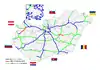
| Country | Hungary |
| Counties | Pest, Nógrád |
| Major cities | Budapest, Dunakeszi, Vác |
| Highway system | |
| |
The M2 expressway (Hungarian: M2-es autóút) is a toll highway in northern Hungary, connecting Budapest to Vác and Banská Bystrica. The first section of the highway opened in 1996. It follows the route of the old Route 2 one-lane highway. The total length of the motorway now is 30 km.
Timeline
| Section | Length | Opened | Notes |
|---|---|---|---|
| Budapest (M0) – Vác észak | 30.0 km (18.64 mi) | Single carriageway: 1998 Second carriageway: 1 October 2019 |
Built between 1996 – 1998. Originaly the name of the route was 2A, and 2B. Both carriageways were fully built between 2017 – 2019 until Vác dél junction. |
| Vác észak – Hont-Parassapuszta (border) | 41 km (25.48 mi) | Planned |
Route description
- The route is expressway. The maximum speed limit is 110km/h, with
 (2x2 lane road) until Vác dél junction.
| County | km | Type | Destination | Notes | |
|---|---|---|---|---|---|
Budapest |
17 |
|
The southern terminus of the Distance is measured from the Zero Kilometre Stone monument in Budapest. | ||
Pest |
21 | Dunakeszi / Fót | |||
| 23 | Dunakeszi-Tóváros / Fót-Kisalag | ||||
| 25 | |||||
| Alagi pihenőhely | parking, petrol station (Shell), motel, café and restaurant
pihenőhely means Rest area | ||||
| 27 | Göd-Iparterület | Ipaterület means Industrial area | |||
| 29 | Göd | ||||
| 34 | Sződliget / Sződ | ||||
| 37 | Vác dél / Gödöllő, Vácrátót | The northern terminus of the expressway.
dél means South | |||
| 39 | Vác-Alsóváros, toward to Tahitótfalu / Rád, Vácduka | 1-lane expressway, planned expansion | |||
| 42 | Vác-Centrum, Deákvár / Kosd | Centrum means center | |||
| 48 | Vác észak, toward to Tahitótfalu / |
Northern side of the road.
észak means North 1-lane expressway, planned expansion | |||
Nógrád |
56 | Nőtincs / Nógrád | Planned | ||
| 59 | dél means South | ||||
| 61 | Rétsági pihenőhely | ||||
| 65 | észak means South | ||||
| 83 | Drégelypalánki pihenőhely | planned petrol station | |||
| 88 | Hont-Parassauszta (H) – Šahy (SK) border crossing |
Planned | |||
1.000 mi = 1.609 km; 1.000 km = 0.621 mi
| |||||
Maintenance
The operation and maintenance of the road by Hungarian Public Road Nonprofit Pte Ltd Co. This activity is provided by this highway engineer.
Payment
Hungarian system has 2 main type in terms of salary:
1, time-based fee vignettes (E-matrica)1, time-based fee vignettes (E-matrica);
- Cars, vans and motorbikes up to 3.5 tonnes only need to buy a single vignette which costs 6,400 Hungarian forint (Ft) for 10 days, 10,360 Ft for 1 month and 57,260 Ft for a year, from 1 January 2024.[1]
2, county vignettes (Megyei matrica); the highway can be used instead of the national sticker with the following county stickers:
Type of county vignette Available section Pest full length (17 km – 48 km)
European Route(s)
| Name | Route | |
| 71 km | ||
See also
References
External links
- Exit list of M2
- National Toll Payment Services Plc. (in Hungarian, some information also in English)
- Hungarian Public Road Non-Profit Ltd. (Magyar Közút Nonprofit Zrt.)
- National Infrastructure Developer Ltd.